Connected Sensor Intelligence
The HEF is currently working on the establishment of an Internet of Things (IoT) sensor network for the agricultural research institutions of the TUM. This includes the provision of a Low Power Wide Area Network (LPWAN) infrastructure and its integration into an appropriate digital platform for storage, interoperable access and display of the generated sensor data. The aim is to provide users with comprehensive and simplified remote access to sensors and sensor data via a network connection.
Presentation at Geospatial Sensing 2020 conference
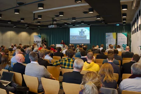
In September 2020, David Gackstetter took the chance to present the current state of development of HEF's sensor data infrastructure at the Geospatial Sensing 2020 conference. The Geospatial Sensing Conference provides a platform for scientists, developers and users to examine current challenges, present best practices and discuss future developments in the fields of earth observation networks, e.g. in-situ sensors and remote sensing systems originating from a variety of domains and backgrounds such as hydrology, marine sciences, traffic management, environmental monitoring, energy supply or smart city systems. The active research and development community works on new approaches to share, manage, discover, analyze, and visualize geospatial sensor data.
Presentation slides can be found at the conference's official website:
Sensor Symposium in Munich
On November 13th/14th 2019, the symposium Sensor Data took place in the Bauzentrum Munich. After the first part of the series of events in Hamburg in March 2019, the "Sensor Data Community" met this time in Munich.
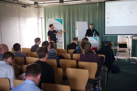
After a series of lectures including a panel discussion on the first day, the "SensorCamp" was organized for the second day, an open conference with workshops oriented in a "BarCamp" format.
The Chair of Geoinformatics and the Hans Eisenmann-Forum were active in all parts of the event. Besides the keynote lecture on "Interoperable Integration of Sensor Data and 3D City Models for Smart Cities", there was another lecture on "IoT based on LoRaWAN" in cooperation with Stadtwerke München. We were also involved in the panel discussion on "Crowdsourcing". On the second day, the path from sensor data from the sensor node to LoRaWAN and the FROST server to an IoT application was explained in detail using a demonstrator in a separate workshop.
[Text: B. Willenborg/TUM, Fotos: GeodatenService Stadt München]
IoT Demonstrators at the Digitalization Fair of the Stadtwerke München (Municipal Utilities Munich)

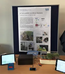
The Chair of Geoinformatics and the Hans Eisenmann-Forum took part in the internal fair of the Stadtwerke München (SWM) on the topic of digitisation on October 17, 2019. On the occasion of the 50th anniversary of the commissioning of the first computer at SWM, digitisation projects from all areas of the company were presented at over 80 stands.
Together they took part with their own stand, where three demonstrators on the topic of the Internet of Things (IoT) were presented. On display were an automatic irrigation system, a people counter and a room climate monitoring unit.
During the course Geoinformatics 3 in summer semester 2019 the students learned the basics of Internet of Things and Geo-Sensor-Networks. For this purpose, the students worked on concrete IoT questions in groups. The projects covered all areas of an IoT application. The entire workflow from the selection and installation of the hardware components including sensors, the programming of microcontrollers and their connection to the Internet to a concrete IoT application was covered. Open Source Software and Open Standards of the Open Geospatial Consortium (OGC) (Sensor Web Enablement Standards Suite [more]) were consistently used for the data and services used. The aim of the course was to teach students the basics of IoT hardware, software, services and open standards by means of practical projects.
Use of the SWM LoRaWAN network
For the course in the summer semester of 2019, the LoRaWAN network of the Stadtwerke München (SWM), which is available throughout the city, was used for the first time. As cooperation partners, the SWM enabled free use of the network for the event. The area-wide LoRaWAN coverage enabled a broad spectrum of IoT projects for the students.
Publications and contributions:
- Gackstetter, David; Moshrefzadeh, Mandana; Machl, Thomas; Kolbe, Thomas H.: Smart Rural Areas Data Infrastructure (SRADI) – an information logistics framework for digital agriculture based on open standards. 41. GIL-Jahrestagung 2021 - Fokus: Informations- und Kommunikationstechnologie in kritischen Zeiten, Gesellschaft für Informatik e.V. (GI), 2021, 109-114 more…
- Moshrefzadeh, Mandana; Machl, Thomas; Gackstetter, David; Donaubauer, Andreas; Kolbe, Thomas H.: Towards a Distributed Digital Twin of the Agricultural Landscape. Journal of Digital Landscape Architecture (5), 2020 more… Full text ( DOI )

